Public Knowledge partnered with The Kitchen Sisters to produce Season 5 of SFMOMA’s Raw Material podcast, centered around the Take Part artist project and scale model. Tune in to San Francisco: Stories from the Model City, to hear planners, librarians, artists, neighborhood activists, and others as they contemplate the past, debate the present, and envision the future of our city by the bay.
Composite image of the 1938 Works Progress Administration Scale Model of San Francisco by David Rumsey and Beth LaBerge.
By Gray Brechin This article was originally published in Calafia, the journal of the California Map Society and used with their permission.
A startling message landed in my inbox ten years ago from a University of California employee overseeing the move of artifacts from a Berkeley warehouse to another warehouse in Richmond. Tamara Garlock wrote: “ We found a 1935 scale model of San Francisco originally created for the 1939 World’s Fair at Treasure Island” which, she said, was stored in sections in sixteen wooden crates. Ms. Garlock had contacted me because she thought that, as the Project Scholar for the Living New Deal, I might have an idea of an alternative home for the model. The University recognized its value but also needed the considerable storage space those crates were taking up in order to hourse its immense Anthropology Museum collection…
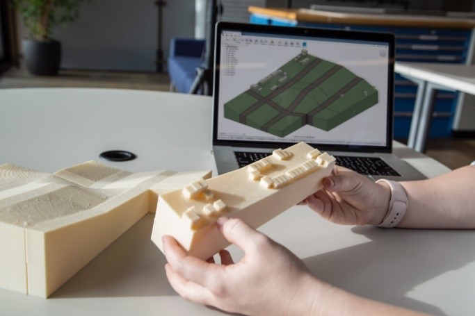
At the request of the San Francisco Museum of Modern Art (SFMOMA), Autodesk employees Marti Deans and Gabrielle Patin helped recreate missing pieces, so the model could include all of the city’s neighborhoods
Lillian Saunders is a sophomore at the University of San Francisco majoring in Urban Studies. She wrote this blog post for Professor Rachel Brahinsky’s Urban Field Course, which visited several sections of the WPA model in Spring 2019.
The Outer Richmond was home to many of the city’s most cherished leisure activities in the late 1930s. Known as the Outside Lands, the Sunset and Richmond Districts were not considered part of San Francisco until 1866. The model showcases Playland-at-the-Beach, the Cliff House, Sutro Baths, the remains of Sutro Heights, the Lincoln Park Golf Course, and the Palace of the Legion of Honor. In the late nineteenth century, wealthy San Franciscans developed the area known as Lands End into a recreational resort, complete with a steam train that carried passengers from downtown to the ocean. The Sutro Baths featured a large, indoor saltwater swimming pool, and was the subject of an 1897 discrimination suit by a black patron, John Harris, who won damages from Adolph Sutro for being refused admission.
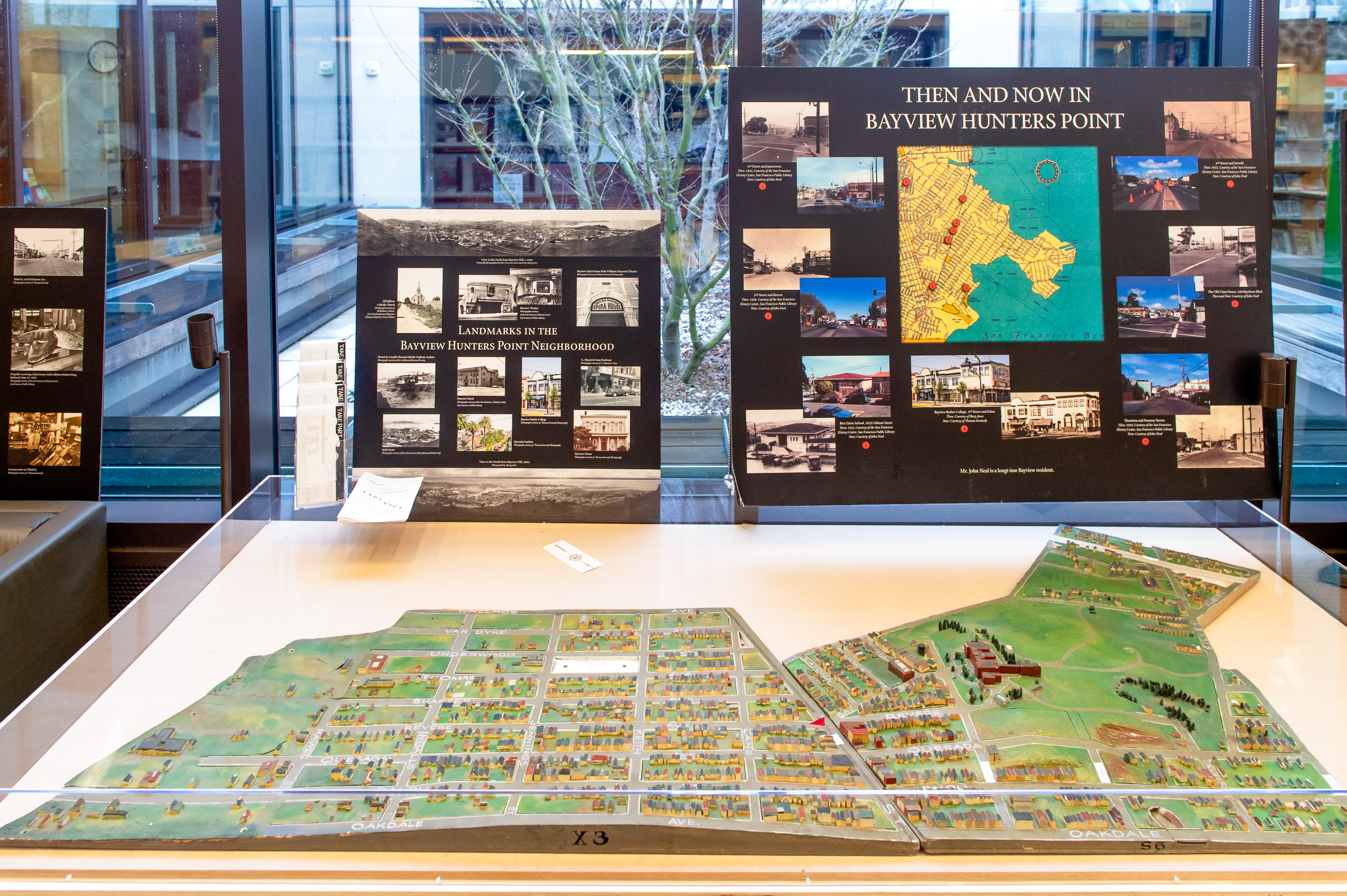
Bayview–Hunters Point was on the precipice of becoming an enormous United States military hub in 1938. Since the late 1860s, shipbuilding and repair had been a major industry in the area; the Bethlehem Shipbuilding Company’s dry docks had seen the construction of numerous ships for World War I. Yet this bayside neighborhood in the city’s southern reaches still had the look and feel of a small pastoral town.
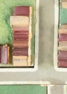
Bernal Heights was known primarily for its open spaces in 1938, but it already had a core village vibe that still defines the neighborhood today. The model depicts businesses popping up on Cortland Avenue, as well as Works Progress Administration projects like the Aztec stairs and this branch of the library. Also easily spotted is Bernal Park, now Precita Park, established by San Francisco supervisors in 1894 and the site of the city’s first Carnaval in 1979.
Between the two World Wars, San Francisco had the largest Chinese American population in the country, the overwhelming majority confined to Chinatown. The scale model highlights many of the neighborhood landmarks from that period that remain iconic today: Portsmouth Square, Tianhou Temple, St. Mary’s Cathedral, the Telephone Exchange building and the YWCA, operative since 1911 but housed in the Julia Morgan-designed building since 1930. Today that building serves as the Chinese Historical Society of America Museum and Learning Center.
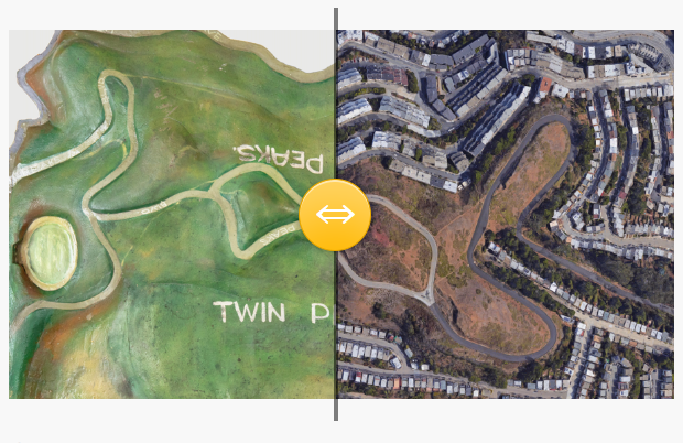
In many ways, 1938 Eureka Valley resembles the present day: the unusual angle of Liberty Street’s peak and the train tracks that cut through Twenty-First and Chattanooga Streets look very familiar. On the model is the Castro Theater, built in 1922 and designed by famed architect Timothy Pflueger, mastermind of the scale model. Also visible is Mission Dolores Park, which continues to be one of San Francisco’s most popular outdoor spots. The park, a former cemetery, was established in 1905 and used as an encampment for displaced citizens after the 1906 earthquake.
The 1930s Excelsior afforded a virtual trip across the world in a matter of minutes: streets with names such as Paris, Lisbon, and Madrid—conjured by developer Emanuel Lewis to lure families from smaller, inner-city dwellings—lined the hill. (Other international street names, including China and Japan, were changed to Avalon and Excelsior following anti-Asian sentiment in the late nineteenth century that gave rise to the Chinese Exclusion Act of 1882.) On the model, the neighborhood is in its infancy, with empty lots and blocks leading up to John McLaren Park.